1. San Francisco’s Embarcadero, California
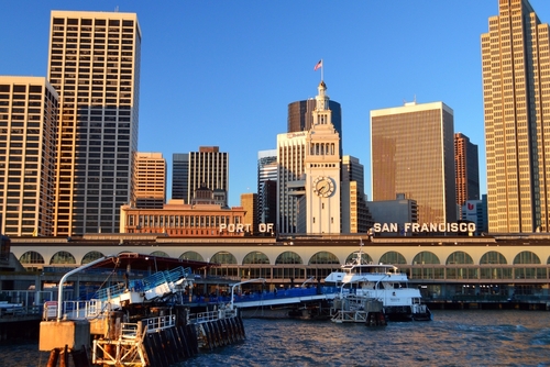
For much of the 20th century, San Francisco’s Embarcadero waterfront was dominated by an elevated freeway. The Embarcadero Freeway ran along the edge of the city and blocked views of the bay from downtown streets. While it helped move traffic, many people felt it cut the city off from its historic waterfront. The structure cast large shadows over the area and made the shoreline less inviting.
The freeway was severely damaged during the 1989 Loma Prieta earthquake and was eventually demolished. Its removal opened the door for a major waterfront transformation. Today the Embarcadero features wide promenades, palm-lined walkways, and restored ferry terminals. The area now feels like an open civic space rather than a transportation corridor.
2. Las Vegas Strip, Nevada
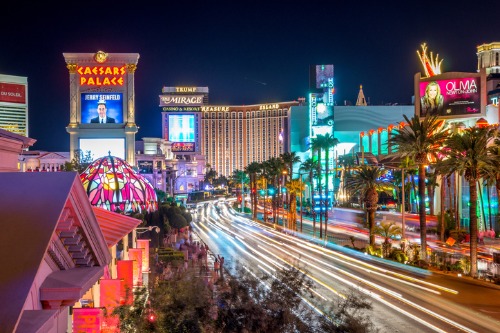
Photos of the Las Vegas Strip from the 1940s and 1950s look almost quaint compared to today’s skyline. Back then, the road was lined with relatively small, low-rise casinos like the Flamingo and the Desert Inn, surrounded by desert. Neon signs were the main attraction, and the overall scale was modest by modern standards. It was glamorous for its time, but far from the towering spectacle people expect today.
Starting in the late 1980s and especially the 1990s, the Strip exploded upward and outward. Mega-resorts like themed hotels and massive casino complexes replaced many earlier properties. Today, enormous buildings dominate the skyline and attractions range from indoor canals to massive observation wheels. The result is a landscape that feels more like a futuristic entertainment corridor than the quiet desert highway it once was.
3. The National Mall, Washington, D.C.
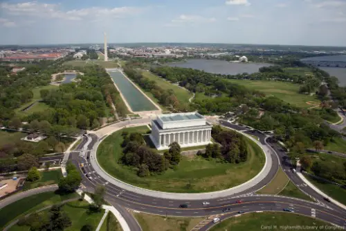
The National Mall might seem timeless, but it once looked surprisingly rough and uneven. In the 1800s and early 1900s, large parts of the area were cluttered with railroad tracks, markets, and temporary buildings. The Mall lacked the clean sightlines and sweeping lawns people associate with it today. It functioned more like a practical city space than a carefully designed national showcase.
A major redesign in the early 20th century reshaped the area into the monumental landscape we know now. Inspired by the McMillan Plan, planners cleared structures and created the long, open park stretching between the Capitol and the Lincoln Memorial. Museums and monuments were added in a more deliberate layout over the decades. The transformation turned a messy urban zone into one of the most recognizable civic spaces in the United States.
4. Niagara Falls, New York
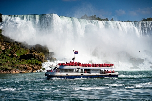
Niagara Falls has always been spectacular, but the surrounding landscape used to be much more chaotic. In the 1800s, factories, mills, and private developments crowded close to the falls. Industrial use of the water and aggressive tourism infrastructure blocked many natural views. Some early visitors complained that the scenery felt overrun by commercial interests.
Conservation efforts eventually reshaped the area dramatically. In the late 19th century, New York created Niagara Falls State Park, removing many industrial structures near the falls. Over time, viewing areas, parkland, and controlled development replaced the cluttered environment. Today, the falls are framed by protected green space that highlights their natural beauty.
5. Detroit Riverfront, Michigan
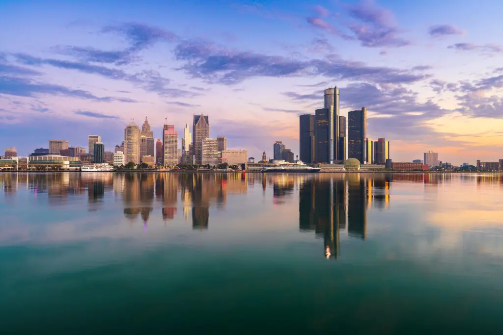
Detroit’s riverfront once reflected the city’s identity as a manufacturing powerhouse. For decades, warehouses, shipping facilities, and industrial infrastructure dominated the shoreline along the Detroit River. Access for ordinary residents was limited, and the waterfront felt more like a working zone than a public gathering place. It was essential to the city’s economy but not particularly inviting.
Beginning in the early 2000s, large redevelopment projects changed the character of the area. Industrial spaces were replaced or converted into parks, walkways, and cultural venues. The Detroit RiverWalk now stretches for miles and has become one of the city’s most popular public spaces. What was once a largely inaccessible industrial corridor is now a vibrant waterfront destination.
6. The Los Angeles River, California
Many people assume the Los Angeles River has always looked like a giant concrete channel. In reality, it used to be a wide, shifting natural river that frequently flooded surrounding communities. Seasonal storms could send water surging unpredictably through the basin. That volatility shaped early settlement patterns in the region.
After devastating floods in the early 20th century, officials undertook massive flood-control efforts. By the mid-1900s, much of the river had been lined with concrete to manage water flow. The result was the stark channel famously seen in films like Grease and Terminator 2. Today, parts of the river are being slowly restored with greenery and public spaces, giving it yet another evolving identity.
7. Coney Island, New York
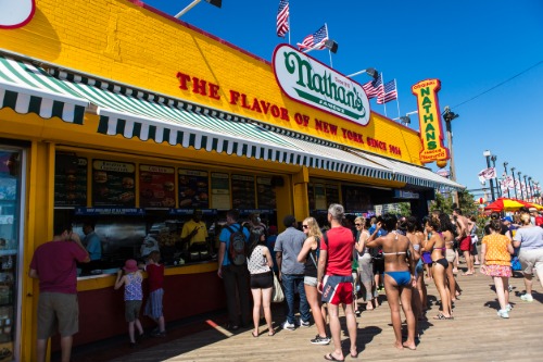
Coney Island in the late 19th and early 20th centuries was packed with extravagant amusement parks. Massive attractions like Luna Park and Dreamland featured elaborate architecture, electric lights, and daring rides that drew huge crowds. The area was one of the most famous entertainment districts in the country. It represented the peak of early American amusement culture.
Fires, economic changes, and shifting tourism trends dramatically altered the landscape. Many of the grand amusement parks disappeared during the 20th century. What remains today includes a smaller amusement area, the famous boardwalk, and historic rides like the Cyclone roller coaster. The atmosphere is still lively, but the scale is far different from its early heyday.
8. The Seattle Waterfront, Washington
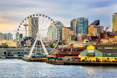
Seattle’s waterfront once looked far more industrial than scenic. In the early 20th century, it was crowded with shipping piers, warehouses, and a busy elevated highway known as the Alaskan Way Viaduct. That concrete structure ran directly along the shoreline and blocked views of Elliott Bay for decades. While it served transportation needs, it made the waterfront feel cut off from the city.
Everything changed after the viaduct was demolished in 2019 following years of planning and earthquake concerns. New redevelopment projects began opening up views and creating pedestrian-friendly public spaces. Parks, plazas, and wider walkways are transforming how people interact with the shoreline. The result is a waterfront that feels far more open and connected to downtown Seattle.
9. Chicago’s Lakefront, Illinois
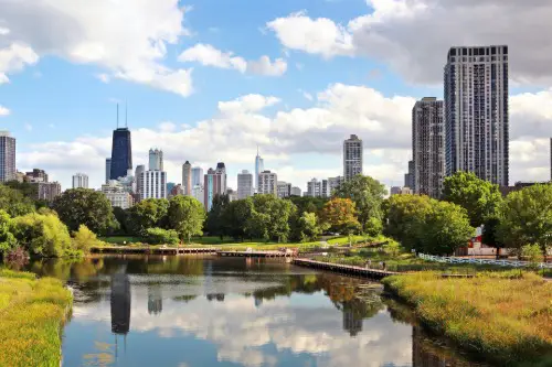
Chicago’s lakefront today is a continuous stretch of parks, beaches, and trails, but it didn’t always look that way. In the 19th century, large portions of the shoreline were industrial or simply undeveloped. Rail lines, warehouses, and shipping infrastructure occupied significant sections of the waterfront. The edge of Lake Michigan functioned more as a working landscape than a recreational one.
City planners and civic leaders gradually pushed to protect the shoreline for public use. Through landfill projects and park development, the lakefront expanded outward into Lake Michigan. The result is the massive green corridor that now includes Grant Park, Millennium Park, and miles of public beaches. Chicago’s shoreline is often called one of the city’s greatest achievements in urban planning.
10. Lower Manhattan, New York City
Lower Manhattan has gone through several dramatic physical transformations. In the early 20th century, the skyline was dominated by relatively modest skyscrapers compared with today’s standards. Streets were packed with financial offices and shipping-related businesses tied to the nearby harbor. The skyline evolved steadily as taller buildings replaced earlier ones.
One of the most significant changes came after the September 11, 2001 attacks. The destruction of the original World Trade Center towers left a massive gap in the skyline and reshaped the area physically and emotionally. In the years since, the neighborhood has been rebuilt with new skyscrapers, memorials, and public spaces. Today’s skyline looks very different from both the pre-2001 era and the earlier 20th century cityscape.
11. Boston’s West End, Massachusetts
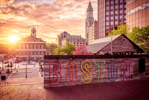
Boston’s West End once held a dense neighborhood filled with narrow streets and immigrant communities. By the mid-20th century, many buildings were old but still occupied by thousands of residents. Small businesses, apartment buildings, and local institutions formed a tightly knit urban environment. It was a classic example of a historic city neighborhood.
In the late 1950s, a controversial urban renewal project changed everything. Most of the neighborhood was demolished and replaced with high-rise residential buildings and modern development. The sweeping redevelopment displaced many longtime residents. Today’s West End bears little resemblance to the street grid and community that existed before the project.
12. Times Square, New York City
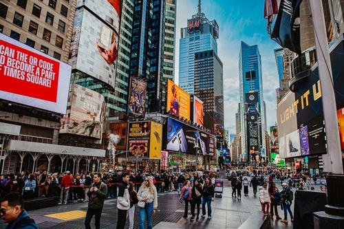
If you could step into Times Square in the early 1900s, you might barely recognize it. What’s now a glowing canyon of LED billboards and pedestrian plazas used to be crowded with cars, gritty theaters, and far fewer lights. Through much of the 1970s and 1980s, the area was also known for adult cinemas and a reputation that scared off many families. The transformation accelerated in the 1990s when New York City began aggressively redeveloping the district and encouraging major corporate tenants.
Today, Times Square is one of the most visited tourist spots on the planet. Bright digital advertising covers nearly every building, and much of Broadway through the square has been turned into pedestrian space. Chain stores, massive flagship locations, and family-friendly attractions dominate the area. The shift from seedy entertainment district to global tourism hub makes the difference between past and present striking.
This post Famous American Locations That Look Completely Different Today was first published on American Charm.