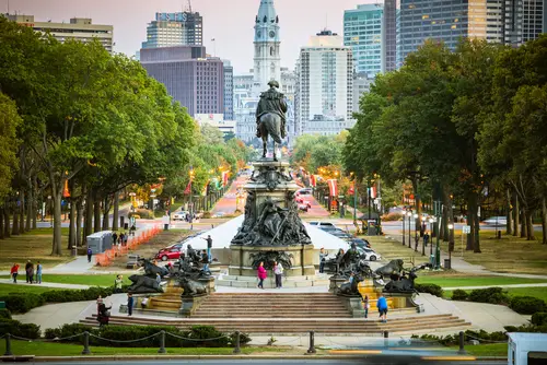
1. New York City, New York

New York City’s famous street grid didn’t happen organically. The Commissioners’ Plan of 1811 imposed a rigid layout of numbered streets and avenues across much of Manhattan. It was designed to make land easier to divide, sell, and develop quickly. The result is a city that feels orderly on the surface but was driven by real estate efficiency.
That grid also erased older roads and natural features in the process. You can still spot the past in places where Broadway cuts diagonally across the pattern. Those odd intersections reveal older paths that predate the plan. It’s a daily reminder that even the most structured cities were once far less predictable.
2. Washington, D.C.

Washington, D.C. was carefully designed to project power and order. Pierre Charles L’Enfant created a plan with grand avenues radiating from key government sites. The layout borrowed ideas from European capitals to reflect national ambition. Wide streets and sightlines were meant to emphasize importance and visibility.
Those broad avenues weren’t just symbolic, they also made troop movement easier in case of unrest. Circles and diagonals break up the grid in ways that feel intentional and ceremonial. The city’s design tells a story about a young nation thinking ahead about both image and control. Even today, the layout shapes how people experience politics in motion.
3. Savannah, Georgia

Savannah’s layout stands out because of its repeating public squares. Founded in 1733 by James Oglethorpe, the city was organized into a system of wards with central green spaces. These squares were meant for community gathering, defense, and organization. The design made the city feel both structured and welcoming.
Many of those squares still exist and define Savannah’s character today. They slow down traffic and create natural meeting points. The layout reflects colonial ideas about balance, safety, and shared space. Walking through them feels like stepping into a carefully planned past.
4. San Francisco, California
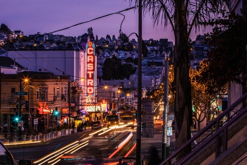
San Francisco’s steep hills didn’t stop planners from imposing a grid. Streets were laid out in straight lines regardless of the terrain. That decision created the dramatic slopes the city is known for today. It also made construction and transportation far more challenging.
Cable cars were later introduced to help people navigate those inclines. The design choice prioritized uniformity over practicality. You can feel that tension every time a street seems almost impossibly steep. It’s a case where ambition shaped the city more than geography.
5. Chicago, Illinois

Chicago’s wide streets and consistent layout reflect a city rebuilt after disaster. The Great Chicago Fire of 1871 destroyed a large portion of the city. Reconstruction brought stricter building codes and more organized planning. Streets were widened to improve safety and movement.
The city also reversed the flow of the Chicago River in 1900. That massive engineering project was designed to protect drinking water from pollution. It permanently changed the region’s geography. Chicago’s layout tells a story of adapting quickly after catastrophe.
6. Boston, Massachusetts
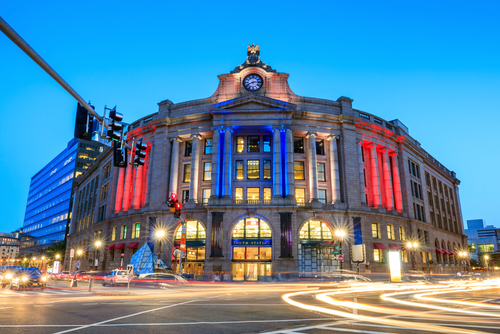
Boston feels different from many American cities because it wasn’t built on a grid. Its streets follow old colonial paths and cow trails that developed over time. The result is a maze-like layout that can feel confusing at first. That irregularity reflects its long history.
Large parts of the city were also created through land reclamation. Areas like Back Bay were once water before being filled in during the 19th century. The street patterns and building styles reflect that planned expansion. Boston’s design shows both organic growth and deliberate reshaping.
7. Los Angeles, California

Los Angeles was shaped heavily by the rise of the automobile. Early planning prioritized wide roads, highways, and sprawling development. Neighborhoods spread out rather than building upward. The design assumed car ownership would be universal.
Streetcar systems once existed but were eventually dismantled. Freeways took their place and defined how people moved through the city. The result is a landscape built for driving above all else. That choice still shapes daily life and traffic patterns.
8. Philadelphia, Pennsylvania
Philadelphia was one of the first U.S. cities to use a planned grid system. William Penn designed it with wide streets and public squares to reduce fire risk. The layout also aimed to prevent overcrowding and improve air flow. It was an early example of urban planning with public health in mind.
The city’s five original squares still anchor its design. Streets were intentionally wider than in many European cities of the time. That spacing helped shape a more open urban feel. Philadelphia’s layout reflects early ideas about order and livability.
9. New Orleans, Louisiana
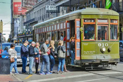
New Orleans’ French Quarter shows a different planning influence. Its grid reflects French and Spanish colonial design rather than English traditions. Buildings sit close to the street with interior courtyards. That setup was suited to climate and social life.
The city’s relationship with water also shaped its layout. Levees, canals, and elevation changes influence where and how people build. Flood risk has always been part of the planning equation. The design reveals a constant negotiation with the environment.
10. Salt Lake City, Utah
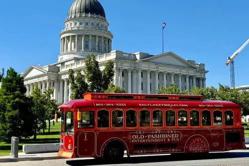
Salt Lake City’s unusually wide streets have a specific origin story. Early Mormon settlers, led by Brigham Young, designed them to accommodate large wagon turns. Some accounts say teams of oxen could turn around without backing up. The grid was built with practicality and community planning in mind.
Those wide streets remain a defining feature today. They make navigation easy but can feel oversized in places. The layout reflects the needs of a frontier settlement preparing for growth. It’s a physical reminder of pioneer priorities.
11. Seattle, Washington
Seattle literally rebuilt itself on top of its past. After the Great Seattle Fire of 1889, the city raised street levels in parts of downtown. Buildings were reconstructed with entrances at the new higher grade. The old ground floors became underground spaces.
Today, the Seattle Underground offers tours through those buried streets. Sidewalks and alleys hide layers of earlier infrastructure. The design choice was a response to flooding and sanitation issues. It left behind a city with a hidden second level.
12. Charleston, South Carolina
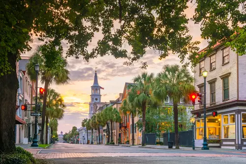
Charleston’s narrow houses, often called “single houses,” are designed with a purpose. They’re oriented sideways to the street with long, narrow profiles. This allows for better airflow in the humid coastal climate. Porches, or piazzas, catch breezes and provide shade.
The layout reflects both environmental adaptation and social customs. Homes were designed to maximize comfort before air conditioning existed. Streets in the historic district show this pattern clearly. It’s architecture shaped directly by climate and lifestyle.
13. Phoenix, Arizona
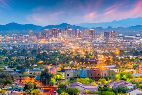
Phoenix’s canal system traces back to ancient engineering. The Hohokam people built extensive irrigation canals in the region over a thousand years ago. Modern Phoenix reused and expanded many of those routes. The city’s growth followed those water pathways.
That infrastructure made large-scale settlement in the desert possible. Streets and neighborhoods developed around access to water. The layout reflects continuity between ancient and modern systems. It’s a rare example of urban design rooted in pre-Columbian innovation.
This post City Design Choices That Reveal Surprising Stories From the Past was first published on American Charm.