1. Silicon Valley, California
Silicon Valley was built for campuses, not communities. Corporate offices are isolated behind parking lots and private roads. Housing is often far from employment centers. Commuting becomes a daily challenge even across short distances.
Public transit struggles to connect dispersed destinations efficiently. Caltrain serves a narrow corridor, leaving many areas uncovered. Biking can be dangerous along high-speed roads. The region’s economic power contrasts sharply with its everyday inconvenience.
2. Houston, Texas
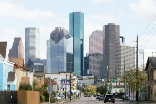
Houston’s lack of traditional zoning has produced some truly awkward land-use combinations. It’s not unusual to find industrial sites, apartments, and strip malls sharing the same block. This patchwork makes walking unpleasant and sometimes unsafe. Sidewalks simply disappear in many areas without warning.
The road system is vast, but congestion is constant despite the width. Bus service is extensive on paper, yet last-mile connections are often missing. Many neighborhoods are cut off by freeways or drainage channels. Getting anywhere without a car can feel like solving a logistics puzzle.
3. Los Angeles, California
Los Angeles was built around the automobile, and it shows in almost every neighborhood. Distances between destinations are deceptively large, even within the same district. Sidewalks exist, but crossing multi-lane roads is stressful and slow. Everyday errands often require navigating traffic that feels like a minor expedition.
Public transit has improved, but it still struggles against the city’s scale. Many rail stations are surrounded by parking lots rather than useful destinations. Buses sit in the same traffic as cars, reducing their reliability. The city works, but it rarely works efficiently.
4. The Villages, Florida

The Villages looks convenient at first glance, especially with its extensive golf cart network. In practice, the system can be confusing and indirect for newcomers. Cart paths don’t always align cleanly with car roads or pedestrian routes. Getting somewhere nearby can involve a surprisingly long loop.
Commercial areas are heavily clustered, forcing residents into the same choke points. Pedestrians outside the core areas face wide roads and limited crossings. Wayfinding signage prioritizes drivers over walkers. The design assumes you already understand the system, which many people don’t.
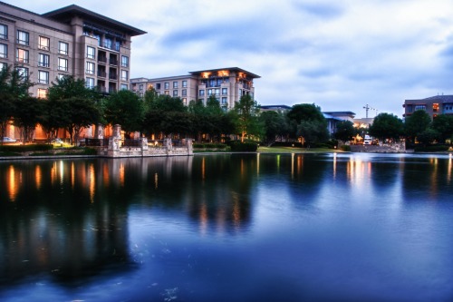
5. Tysons Corner, Virginia
Tysons Corner grew as an edge city before it grew as a place for people. Massive office buildings sit along roads that are hostile to pedestrians. Sidewalks exist in fragments, often ending abruptly. Crossing the street can feel more like crossing a highway than a city block.
The arrival of Metro stations helped, but the surrounding land use didn’t catch up quickly. Long distances between entrances and destinations remain common. Surface parking lots still dominate key areas. It’s a place that was retrofitted for walkability rather than designed for it.
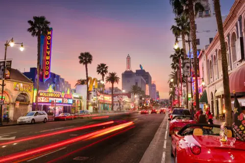
6. Las Vegas, Nevada
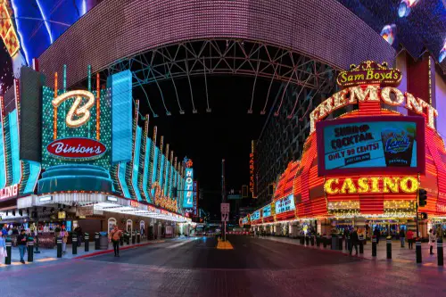
Las Vegas Boulevard looks walkable on a map, but reality is very different. Casino entrances are set far back from the street, stretching short walks into long treks. Pedestrians are often funneled through footbridges and escalators instead of crosswalks. What looks close is rarely close.
Outside the Strip, the city becomes intensely car-dependent. Residential areas are isolated from shopping and services. Bus routes exist but often require long waits in extreme heat. The environment discourages walking even when distances are technically manageable.
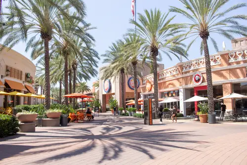
7. Orlando, Florida
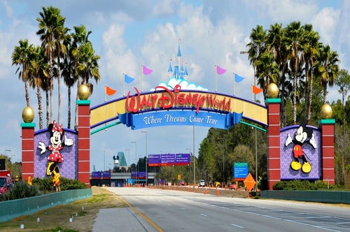
Orlando’s development patterns revolve around tourism rather than daily life. Attractions are separated by wide roads, parking lots, and gated entrances. Sidewalks are inconsistent, especially outside resort zones. Walking between nearby destinations is often impossible or unsafe.
Public transit struggles to serve a region built for rental cars. Bus routes are slow and indirect due to sprawling development. Many residents commute long distances with few alternatives. The city works best if you plan everything around driving.
8. Plano, Texas
Plano is clean, orderly, and deeply inconvenient without a car. Zoning separates housing from shopping and offices with great efficiency. That separation forces even short trips onto major roads. Walking is technically allowed but rarely comfortable.
Sidewalks exist but often run alongside high-speed traffic. Intersections are large, with long waits and short crossing times. Transit coverage is limited relative to the city’s size. Daily life assumes you will drive everywhere.
9. Irvine, California
Irvine is meticulously planned, which paradoxically creates its own problems. Residential villages are neatly separated from commercial centers. That separation makes spontaneous errands difficult without a car. Everything feels just far enough away to discourage walking.
The street layout favors wide roads and synchronized traffic flow. Pedestrian routes are indirect and often hidden. Bus service exists but is sparse outside peak corridors. The design prioritizes order over convenience.
10. Scottsdale, Arizona
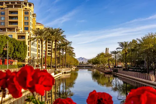
Scottsdale blends resort living with suburban sprawl in awkward ways. Popular areas are connected by wide roads that prioritize cars and valet drop-offs. Sidewalks can be narrow or exposed to intense sun. Walking short distances can feel unnecessarily exhausting.
Public transit options are limited compared to neighboring cities. Bike infrastructure exists but is fragmented. Many destinations are clustered along arterial roads rather than within neighborhoods. Convenience depends heavily on driving.
11. Phoenix, Arizona

Phoenix is famously spread out, and that sprawl shows up in daily life fast. Many neighborhoods are miles from basic errands, making a car mandatory even for a quick grocery run. Summer heat regularly tops 110°F, yet shade, tree cover, and sheltered bus stops are inconsistent or missing. Walking or waiting for transit can feel physically punishing rather than merely inconvenient.
The street network relies heavily on wide arterial roads that prioritize speed over safety. Crossing the street often means navigating six or more lanes of traffic with long signal waits. Public transit exists but struggles to compete with the sheer distances involved. The result is a city that functions best if you drive and breaks down if you don’t.
This post America’s Most Inconveniently Designed Communities was first published on American Charm.