1. Interstate 395 – Urban Bottlenecks
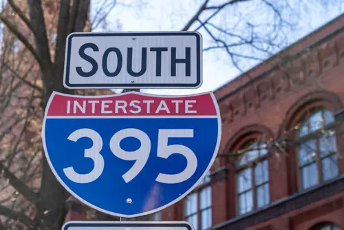
I-395 runs from downtown Boston to Washington, D.C., threading through urban congestion. It shows the other side of highway growth: when roads can’t keep up with demand. Commuters experience firsthand the limitations of car-centric urban planning. Its stop-and-go traffic illustrates the challenges of fitting a big country into city streets.
This highway tells a story of expansion meeting density. Urban highways like I-395 reveal how planning for cars transformed cities, often at the cost of walkable neighborhoods. Congestion and maintenance are constant issues, proving that growth comes with trade-offs. For anyone stuck in rush hour, it’s a reminder that America may be too big to drive comfortably.
2. Route 66 – The Mother Road
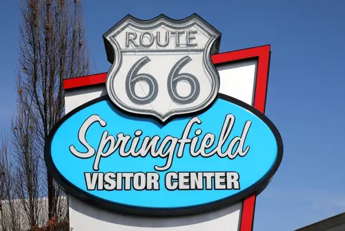
Route 66 is more than asphalt; it’s the backbone of the American migration story. Stretching from Chicago to Santa Monica, it was the road that defined cross-country travel for decades. People flocked to it during the Dust Bowl, chasing hope in California, making it a lifeline for the displaced. Its iconic motels, diners, and neon signs became symbols of a car-centric culture taking root.
Even as the interstate system replaced it, Route 66 remains a nostalgic reminder of how America’s love for the open road shaped development. Its popularity fueled small towns, gas stations, and roadside attractions that couldn’t survive without the automobile. Driving it today feels like stepping into a living museum of mid-century America. Every turn tells a story about a time when highways were destinations in themselves.
3. Interstate 10 – From Sea to Shining Sea
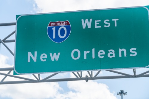
I-10 stretches from Los Angeles to Jacksonville, linking deserts, swamps, and everything in between. It embodies the scale of America, crossing multiple time zones and ecosystems, forcing drivers to confront long, lonely stretches of pavement. Its size makes clear how the country’s geography demanded massive infrastructure to keep people and goods moving. Along the way, it carries the tension between urban sprawl and the open road.
This highway shows the balancing act between speed and accessibility. Cities like Phoenix, Houston, and New Orleans rely on I-10 for commerce and commuting, but traffic snarls are inevitable. Its existence proves that driving long distances became a necessity, not a leisure activity. Without it, much of the modern South and Southwest would look entirely different.
4. Interstate 5 – The West Coast Lifeline
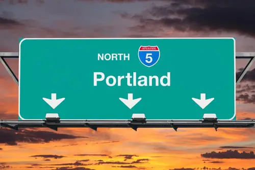
I-5 runs nearly the entire length of the West Coast, from the Mexican border to Canada. It’s the artery connecting major cities like San Diego, Los Angeles, and Seattle, highlighting the country’s westward growth. The highway also demonstrates how regional traffic patterns evolved; from beachgoers in LA to tech commuters in the Bay Area, everyone depends on it. Its congestion is proof that even massive highways have limits.
I-5 also tells the story of commerce in motion. Freight trucks dominate the highway, illustrating how America’s supply chains hinge on car and truck traffic. The route’s history of expansion mirrors the population boom along the Pacific. Driving it, you see firsthand the collision of suburban sprawl, industrial needs, and scenic vistas.
5. Interstate 80 – Crossing the Heartland
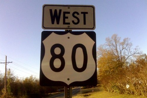
I-80 stretches from San Francisco to Teaneck, New Jersey, and cuts through the heart of the Midwest. It’s the route that reminded Americans just how vast the country is. Farmers, truckers, and road-trippers all rely on it, making it a corridor of movement that shaped both commerce and culture. Long stretches across Nebraska and Iowa reveal how driving became a necessity for connecting distant communities.
The highway also illustrates America’s love affair with straight, uninterrupted roadways. It’s efficient, but also exposes the monotony of sprawling infrastructure. Yet, I-80 fueled economic expansion, linking ports on both coasts to the interior. Its construction changed towns along the route, often forcing them to reinvent themselves for the highway era.
6. Interstate 70 – Linking East and West
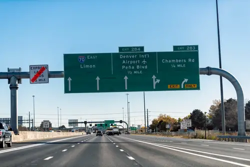
I-70 runs from Baltimore to Utah, bridging the Atlantic seaboard with the Rocky Mountains. It cuts through cities, suburbs, and farmland, showing how America grew around the car. Its mountain passes are engineering marvels, highlighting how Americans refused to let geography stop their drive. Travelers experience both the thrill of scenic vistas and the frustration of congestion in urban stretches.
I-70 also shows how highway construction shaped regional economies. Cities along the route expanded with easier access to trade and commuting. Tourist destinations, like the Colorado Rockies, owe their popularity to this highway. It’s a reminder that highways aren’t just about movement—they’re about shaping where people live, work, and play.
7. Interstate 40 – From the Desert to the Delta
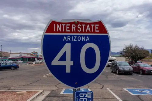
I-40 stretches from Barstow, California, to Wilmington, North Carolina, crossing deserts, plains, and the Mississippi Delta. It mirrors Route 66 in some ways, carrying the story of migration, commerce, and leisure. Its massive reach highlights the dependence on long-haul driving to connect diverse regions. Drivers can experience a little bit of every American landscape in one trip.
The highway also underscores how population shifts required infrastructure upgrades. Trucking, road trips, and regional commerce all intersect along I-40, making it a lifeline for mid-sized cities. The road’s history reflects the postwar expansion that made driving a default mode of travel. Even today, it demonstrates the tension between accessibility and overextension.
8. Interstate 15 – Desert and Development

Interstate 15 runs from San Diego to the Canadian border through the desert Southwest. Its route mirrors the pattern of growth in cities like Las Vegas, Salt Lake City, and Los Angeles. The highway shows how development followed the road rather than the other way around. Long stretches of desert punctuated by booming cities demonstrate the scale of America’s sprawl.
I-15 also represents the logistical challenges of highway expansion. From heavy tourist traffic to freight transport, it handles multiple roles simultaneously. Its construction highlights how highways became critical arteries for both economy and leisure. Driving along it, you can see why planning for growth often outpaced the roads themselves.
9. Interstate 90 – The Northern Connection
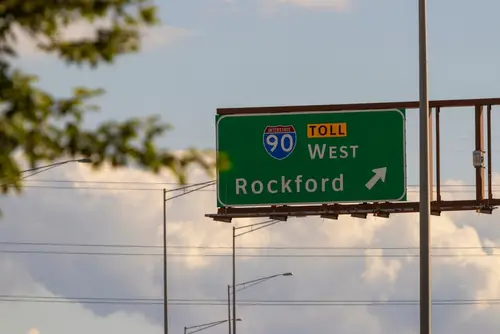
I-90 is the longest interstate in the U.S., running from Seattle to Boston. It’s the northern equivalent of I-80, connecting major cities with small towns and industrial hubs. Its sheer length reminds drivers that America’s geography isn’t small, and that long-distance travel is integral to daily life. Winters can turn it into a test of endurance, underscoring the demands of national highways.
The highway also reflects urban and suburban expansion patterns. Cities along I-90 grew in response to its presence, showing how roads shape development. The mix of industrial zones, college towns, and urban sprawl illustrates a country too big to move through easily. I-90 is a rolling lesson in both ambition and congestion.
10. Interstate 70/76 Split – The Rocky Mountain Challenge
Where I-70 meets I-76 in Colorado, you see the challenge of driving in rugged terrain. Mountain passes and high-altitude stretches require engineering ingenuity and patience from drivers. It shows how expansion into the West demanded highways that could handle extreme geography. Traffic jams and slow climbs reveal that even big roads can’t fix natural limits.
This segment also highlights the economic importance of freight and tourism. Ski resorts, mining towns, and urban centers all depend on these routes. The highway demonstrates that growth often outpaces the infrastructure meant to support it. Driving it gives a literal sense of America’s ambition—and its complications.
11. Interstate 84 – Linking the Northwest
Interstate 84 connects Portland to Utah, running through scenic valleys and desert plateaus. It’s less famous than other interstates, but vital for the Pacific Northwest’s connectivity. The highway illustrates how regional development depended on roads cutting through rugged terrain. It also shows how population growth pushed transportation into less populated areas.
I-84 is a case study in balance between utility and preservation. Agricultural transport, commuter traffic, and recreational travel converge on this route. Its construction impacted towns along the way, shaping economies and migration patterns. It’s a reminder that even “secondary” highways are critical to the story of a nation too big to drive.
12. Interstate 95 – The East Coast Artery
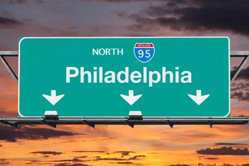
Interstate 95 is the highway that never sleeps. Running from Miami to Maine, it’s the spine of the East Coast, carrying commuters, trucks, and tourists alike. It slices through major cities, connecting dense urban centers and sprawling suburbs, highlighting how traffic congestion became a defining problem. Its endless construction projects are a testament to America outgrowing its roads almost as fast as they were built.
I-95 also reveals how economic growth demanded bigger, busier highways. Shipping lanes and trucking routes turned it into a commercial lifeline, but also a reminder of the limits of driving everywhere. The bottlenecks and bridge repairs tell stories of a highway stretched too thin. For anyone who’s sat in New Jersey traffic, it’s proof that bigger isn’t always better.
This post 12 Highways That Tell the Story of How America Got Too Big to Drive was first published on American Charm.