1. Castillo de San Marcos National Monument, Florida
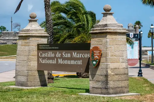
Located in St. Augustine, this Spanish-era fortress was designated a national monument in 1924. But in the original boundary paperwork, early surveyors mistakenly included parts of the nearby city. This led to disputes over which parts were federally managed and which were still under local control. The error wasn’t fully addressed until decades later.
The mix-up created bureaucratic headaches, especially when it came to renovations and city planning. It also confused tourists trying to figure out where the monument “ended.” Even the National Park Service had to update maps several times to clarify things. It was a small mistake, but one that complicated local governance for years.
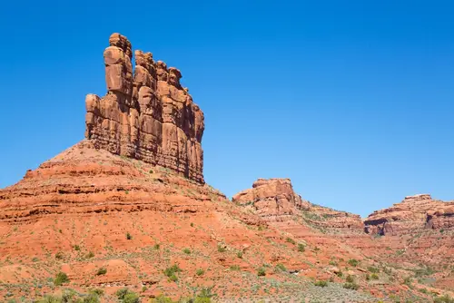
2. Four Corners Monument, Utah (Sort of)

Most people visiting the Four Corners Monument believe they’re standing precisely at the intersection of Utah, Colorado, New Mexico, and Arizona. But due to surveying errors in the 19th century, the actual “correct” spot is about 1,800 feet east of the monument. The current location was officially accepted because it had already been long established and used. So, technically, it’s in the wrong place—but legally, it’s just fine.
Despite the error, the monument draws tons of visitors who love the novelty of touching four states at once. The mix-up happened because early surveyors lacked GPS or even really accurate longitude tools. Still, the monument represents the government’s final decision, not geographic perfection. So it’s more about symbolic geography than scientific precision.
3. Bears Ears National Monument, Utah
When President Obama designated Bears Ears in 2016, many praised the move as a win for conservation and tribal nations. But controversy erupted over the boundaries, which were drawn without full tribal consensus and missed several key cultural sites. Some sacred sites and petroglyphs actually fell outside the final monument area. That left tribes feeling like the most important places had been sidelined.
Later, President Trump shrank the monument by 85%, complicating things even more. President Biden restored the original size in 2021, but the border issues remain. Critics argue the monument still doesn’t fully reflect tribal input or protect what matters most. In this case, it’s not so much about being in the “wrong” spot—just the wrong version of the spot.
4. Statue of Liberty National Monument, New Jersey (Not New York)
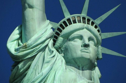
Most people assume the Statue of Liberty is in New York, but it’s actually in New Jersey waters. The monument stands on Liberty Island, which is owned by the federal government but geographically closer to Jersey City. A 1998 Supreme Court case even confirmed New Jersey’s domain around the island. Despite this, everyone continues to associate Lady Liberty with New York.
The state line issue goes back to an 1834 compact between the two states. At the time, nobody thought the island’s exact location would ever matter so much. Now it’s a footnote in the history of one of America’s most iconic symbols. Technically, she’s standing in the wrong state—but for branding purposes, she’s forever a New Yorker.
5. Grand Canyon–Parashant National Monument, Arizona
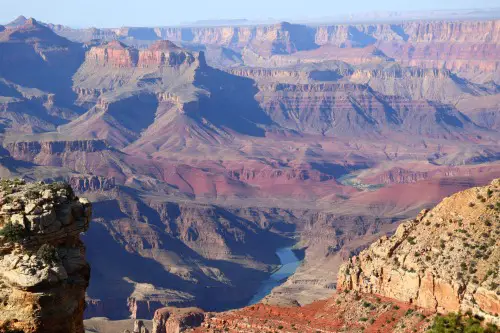
When this monument was created in 2000, it was intended to protect a vast swath of remote wilderness. But planners accidentally excluded a chunk of land that contained a major ancient Puebloan site. The error happened because early mapping used satellite images that didn’t clearly show the site’s full extent. Archaeologists later realized part of the ruins were just outside the monument boundaries.
Fixing the problem hasn’t been easy. Since the land is managed by the Bureau of Land Management and not the Park Service, there’s bureaucratic red tape involved. Officials have talked about expanding the boundaries, but no action has been taken. Meanwhile, the site remains vulnerable due to its exclusion.
6. Organ Pipe Cactus National Monument, Arizona
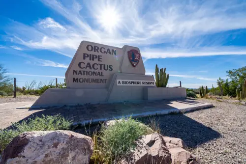
Established in 1937, this monument was supposed to protect the unique flora and fauna of the Sonoran Desert. But part of the designated land included rugged terrain with no significant organ pipe cactus populations. Early surveyors didn’t fully understand the plant’s natural range, leading to a mismatch between the monument’s purpose and its geography. Essentially, they protected the wrong desert stretch.
Biologists later identified areas outside the monument that had far denser cactus growth. That irony hasn’t gone unnoticed by conservationists. While the monument still has ecological value, its namesake plant isn’t nearly as dominant there as once thought. It’s like naming a bird sanctuary after the wrong bird.
7. Fort Matanzas National Monument, Florida
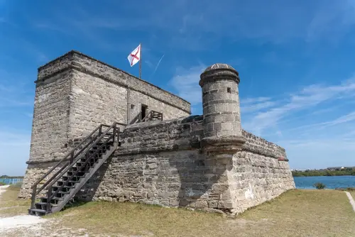
Fort Matanzas was meant to defend the southern approach to St. Augustine from British attack. But the site chosen for the monument doesn’t align perfectly with the historical battlefield zones nearby. Modern archaeological surveys revealed that several key skirmishes actually happened off the designated land. That means some of the “protected history” is literally outside the monument’s fence.
The mistake wasn’t malicious—just a result of 18th-century maps and shifting coastlines. Still, it’s made it harder for historians to fully preserve the site’s context. Attempts to reconfigure the monument boundaries have met resistance due to cost and land ownership issues. So for now, part of the history is left unguarded.
8. Pipestone National Monument, Minnesota
This monument was created to preserve Native American quarrying traditions for a sacred red stone used in pipes. But the original survey didn’t fully account for all active quarry sites used by Indigenous people. As a result, some of the most culturally significant areas were excluded from protection. The misstep continues to spark debate among tribal leaders.
Over the years, tribes have requested boundary adjustments to reflect their actual quarrying history. While some progress has been made, the monument still doesn’t encompass the full range of traditional use. This has limited cultural preservation efforts and ceremonial access. It’s a case of good intentions colliding with bad mapping.
9. Cedar Breaks National Monument, Utah
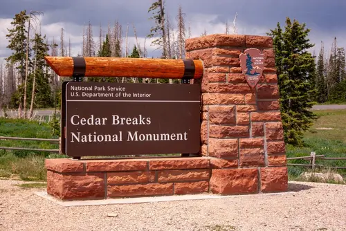
This stunning high-elevation monument protects colorful rock formations and alpine meadows. But early geologists who helped define the borders misunderstood where the most unique geological layers actually were. As a result, the monument’s boundaries cut off just before a zone of rare fossils and mineral formations. That left some of the coolest features sitting just outside its protection.
Later surveys tried to compensate by expanding interpretation areas, but the core borders remained the same. Researchers now have to get special access permits to study areas technically outside the monument. It’s another example of how fast-moving designations sometimes miss their mark. The geology didn’t move—the paperwork just got it wrong.
10. Hovenweep National Monument, Utah-Colorado Border
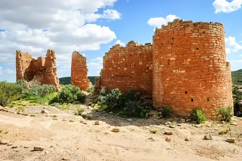
Hovenweep protects a series of ancient stone structures built by ancestral Puebloans. But some ruins that were once thought to be “outliers” were later found to be integral parts of the core settlement system. Unfortunately, they’re located just outside the monument’s official boundaries. That means they’re not federally protected, even though they’re historically vital.
Archaeologists have advocated for the inclusion of these sites, but redrawing lines across two states is no small feat. The original designation was based on incomplete surveys and assumptions about settlement patterns. With new data emerging, it’s clear that the monument didn’t go far enough. It protects a fraction of a much larger cultural landscape.
11. Navajo National Monument, Arizona
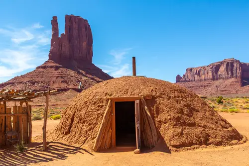
This monument protects several cliff dwellings, including Betatakin and Keet Seel. But due to misinterpretation of early archaeological notes, some nearby dwellings were excluded from the official map. These sites turned out to be just as significant but were later found on adjacent tribal land. So they remain unprotected by federal monument status.
While the Navajo Nation oversees much of this land, it limits access to researchers and visitors. This disconnect has complicated efforts to present a full picture of the ancestral villages. Ironically, a monument meant to preserve Navajo heritage missed some of its most important parts. The gap highlights how critical early surveying accuracy really is.
12. Wupatki National Monument, Arizona
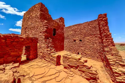
Wupatki is famous for its red sandstone pueblos, but it wasn’t always clear how far the cultural influence extended. Early 20th-century planners underestimated how far the surrounding sites stretched. So the official monument boundary left out dozens of smaller ruins tied to the main settlement. These areas are now vulnerable to looting and development.
Since the oversight, archaeologists have pushed to increase protective zoning around the monument. But federal designation processes are slow and often political. As a result, key parts of the Wupatki cultural network remain outside the “safe zone.” It’s a textbook case of drawing the line too early.
13. Cabrillo National Monument, California
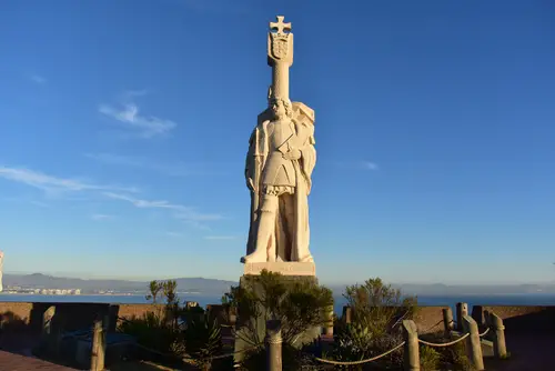
This San Diego monument honors Juan Rodríguez Cabrillo, the first European to land on the West Coast. But historians later questioned whether he actually landed at the site the monument marks. Some now believe the true landing was closer to modern-day Oceanside, about 40 miles north. That puts the monument in a more scenic, but potentially wrong, spot.
The location was chosen in 1913 for symbolic visibility and public access. It sits dramatically atop Point Loma, offering sweeping ocean views—but likely not historical accuracy. Despite this, the monument remains a staple of San Diego tourism. It’s a mix of myth and memory rather than pinpoint precision.
14. Effigy Mounds National Monument, Iowa
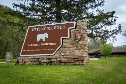
Effigy Mounds preserves ancient Native American earthworks shaped like animals. But when the monument was created in 1949, planners didn’t consult local tribes about the full extent of the burial grounds. Later studies found more mounds and burial sites just outside the designated area. Some of those are now under private land or state jurisdiction.
Tribal communities have long pushed for boundary revisions to better protect these sacred spaces. So far, efforts have moved slowly due to land ownership complexities. The monument as it stands is only a partial representation of the cultural landscape. Once again, well-meaning preservation missed the mark—by a few hundred feet.
This post 14 National Monuments That Were Accidentally Built in the Wrong Spot was first published on American Charm.