1. South Florida — Allowing Development Without Elevation Standards

South Florida permitted dense development in low-lying coastal areas. For decades, planners assumed drainage and pumps could manage flooding. Cities like Miami expanded rapidly at or near sea level. Climate risk was not factored into zoning decisions.
As sea levels rose, infrastructure failures became frequent. Insurance costs spiked and property values destabilized. Retrofitting drainage and raising roads is extremely expensive. The region now faces compounding risk baked into its built environment.
2. Coastal California — Enforcing Single-Family Zoning Almost Everywhere
Much of coastal California locked itself into low-density zoning starting in the 1950s. Cities like San Jose, Palo Alto, and Los Angeles restricted most residential land to single-family homes. This happened even as job growth accelerated in tech, entertainment, and logistics. Housing supply was never allowed to match employment growth.
Over decades, this created chronic housing shortages. Workers were pushed farther inland, increasing congestion and emissions. Infrastructure costs ballooned as regions sprawled outward. The affordability crisis is now so embedded that it constrains economic growth statewide.
3. The Northeast — Redlining as an Official Planning Tool

Cities across the Northeast, including Chicago, New York, Boston, and Philadelphia, were shaped by federal redlining maps. These maps explicitly labeled minority neighborhoods as high-risk for investment. Banks, insurers, and planners followed them for decades. Disinvestment was not accidental; it was procedural.
Neighborhoods starved of capital fell into disrepair. Property values stagnated, weakening municipal tax bases. Schools and services suffered as a result. Entire metro regions still reflect these patterns in wealth, health, and opportunity gaps.
4. The Sun Belt — Overbuilding Parking as a Land-Use Priority
Fast-growing Sun Belt cities like Houston, Phoenix, and Atlanta mandated large amounts of parking for nearly every new building. These rules assumed universal car ownership and peak demand usage. Downtown land that could have supported housing or offices became surface lots. The urban form spread outward as a result.
Parking requirements increased construction costs and discouraged density. Walkability suffered, making transit investments less effective. Once land was paved, redevelopment became difficult and expensive. The region’s growth model became locked into sprawl and congestion.
5. The Southwest — Planning Growth Without Securing Water Supplies

Southwestern cities expanded rapidly despite limited water resources. The Colorado River Compact was based on overly optimistic flow estimates. Cities like Las Vegas and Phoenix planned massive population growth assuming water shortages could be engineered away. Long-term hydrological limits were ignored.
As drought intensified, those assumptions collapsed. Water scarcity now threatens housing approvals and agricultural output. Retrofitting cities for conservation is costly and slow. Entire regions face growth ceilings because early planning discounted environmental reality.
6. The Southeast — Separating Jobs and Housing by Zoning Law

Many Southeastern metro areas zoned employment and residential uses far apart. Cities like Atlanta and Charlotte expanded office parks far from housing. This separation was intentional, based on mid-century planning ideals. Mixed-use neighborhoods were often prohibited outright.
The result was extreme commute dependence. Traffic congestion became a daily regional tax on productivity. Transit systems struggled because destinations were too dispersed. The spatial mismatch locked regions into inefficiency.
7. Appalachia — Ignoring Economic Diversification After Industrial Decline
Planning in Appalachia long assumed coal and heavy industry would remain dominant. Towns were built around single employers with little backup strategy. When industries declined, land use and infrastructure had no alternative purpose. Regional plans failed to anticipate transition.
Vacant industrial sites became environmental and economic liabilities. Younger residents left in search of opportunity. Tax bases collapsed, limiting reinvestment capacity. The lack of diversified planning locked the region into prolonged decline.
8. The Great Plains — Designing Towns Entirely Around Automobiles

Many Great Plains cities rebuilt after World War II around driving alone. Downtowns were redesigned with wide roads and minimal pedestrian infrastructure. Small cities like Wichita and Omaha removed streetcars without replacing them. The assumption was that cars would always dominate.
As populations aged, car dependence became a liability. Downtown retail weakened as driving distances increased. Transit options remained limited or nonexistent. Regional mobility became fragile and exclusionary.
9. The Midwest — Routing Interstates Straight Through City Centers
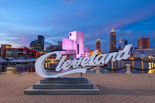
In the mid-20th century, Midwestern cities like Detroit, Cleveland, and St. Louis routed new interstate highways directly through their urban cores. This was framed as modernization and efficiency, but it often targeted neighborhoods with the least political power. Entire commercial corridors and residential districts were demolished to make room for roads. The planning logic prioritized regional car travel over local economic stability.
Once these highways were in place, downtowns lost population and tax revenue rapidly. Businesses followed residents to the suburbs, hollowing out city centers. Public transit systems weakened as ridership declined. The region became structurally dependent on long car commutes and fragmented urban form.
10. The Pacific Northwest — Blocking Urban Density to Preserve “Neighborhood Character”
Cities like Seattle and Portland restricted multifamily housing across most residential land. The goal was to preserve the look and feel of existing neighborhoods. These policies remained even as population growth surged. Density was treated as a threat rather than a tool.
Housing shortages followed quickly. Prices rose faster than wages, pushing residents outward. Transit investments struggled to keep up with dispersed growth. The region became locked into affordability and access problems.
11. The Rust Belt — Demolishing Rather Than Adapting Legacy Infrastructure

Post-industrial cities often responded to decline by tearing down buildings. Urban renewal programs cleared large areas for projects that never materialized. Cities like Buffalo and Youngstown lost walkable street grids. The assumption was that growth would return on its own.
Vacant land fragmented neighborhoods and reduced density. Infrastructure costs remained high despite fewer residents. Revitalization became harder without intact urban fabric. Planning decisions locked these regions into long-term recovery challenges.
This post These Planning Decisions Locked Entire Regions Into Failure was first published on American Charm.